The Israel High Court of Justice (the Supreme Court) is due to issue a ruling soon on the route of the barrier in the Gush Etzion area.
(11/27/06)
Settlements in Focus
The Etzion Bloc and the Security Barrier (Vol. 2, Issue
14)
A publication of Americans for Peace Now

Click on map for larger version.
The Israel High Court of Justice (the Supreme Court) is due to issue a ruling soon on the route of the barrier in the Gush Etzion area. What is the background to this court case?
As most people are aware, over the past five years Israel has been building a barrier - in some areas a wall, in other areas a fence, usually flanked by security roads, ditches, and other setback arrangements - ostensibly for the purpose of separating Israel from the Palestinians for security reasons (e.g., to stop suicide bombers from entering Israel). Indeed, the barrier, where it has been constructed thus far appears to have substantially diminished terrorist attacks inside Israel.
All told, the planned barrier will be over 700 km long, as compared to the 1967 border between Israel and the West Bank (the Green Line), which is only 316 km long. The difference in length is due to the fact that the security barrier, as currently planned and being constructed, dips deep into the West Bank, effectively annexing parts of the West Bank to Israel. In the face of harsh domestic and international criticism (including a case raised against Israel in the International Court of Justice), the government of Israel has consistently maintained that the route of the barrier is based solely on security rationale and justified by the sovereign right of self-defense. However, examination of the impact of the route on the ground discloses clearly the fact that other considerations - namely, the desire to annex settlement blocs and surrounding lands to Israel - has played a dominant role in the determination of the route.
Gush Etzion (the Etzion Bloc of settlements, located south of Jerusalem) is one of the largest areas which the security barrier will de facto annex to Israel (for details of the history of Gush Etzion, including why the area is of special importance to Israelis, see: Settlements in Focus, Vol. 1, Issue 14). Some Palestinians who are being harmed by the route of the barrier in this area have taken their case to the Israeli High Court of Justice, arguing that the damage being inflicted on them is not proportional to the value the barrier has to Israel. This "proportionality" argument is based on a landmark Israeli High Court ruling in 2004, in which the Court ruled that part of the route of the barrier near Jerusalem had to be altered, finding that the route in the area in question:
"...is not proportionate. The route disrupts the delicate balance between the obligation of the military commander to preserve security and his obligation to provide for the needs of the local inhabitants. This approach is based on the fact that the route which the military commander established for the Security Fence - which separates the local inhabitants from their agricultural lands - injures the local inhabitants in a severe and acute way, while violating their rights under humanitarian international law.The route of the Separation Fence severely violates their right of property and their freedom of movement. Their livelihood is severely impaired. The difficult reality of life from which they have suffered (due, for example, to high unemployment in that area) will only become more severe.These injuries are not proportionate. They can be substantially decreased by an alternate route." (HCJ 2056/04, paragraphs 60-61)
What is the current state-of-play in the case and on the ground?
The High Court is due to rule soon on the Gush Etzion appeals, and until then the Court has frozen construction on a large portion of the barrier in this area. In the meantime, intense construction has been underway for the past 6 months on the rest of the barrier in the area (mainly in an area running parallel to Route 60).
Isn't the route of the barrier dictated by vital security considerations?
No. In December 2005, Bimkom and Btselem (two leading Israeli NGO's) jointly published a report entitled, "Under the Guise of Security." In this report the authors systematically refute the Government of Israel's assertion that the barrier is being built according to optimal security requirements. Their report demonstrates that instead, the route of the barrier has been designed both to annex settlements and settlement blocs, and to accommodate future expansion plans of these settlements.
The same type of dynamic is seen in the Gush Etzion area, where, under the cover of the term "Gush Etzion" - which as noted earlier, has historical significance to Israelis, but refers to a much smaller area - the route is being used to annex a huge area of the West Bank.
For the record, Peace Now and Americans for Peace Now support the right of Israel to defend its population from terrorist acts of all kinds, recognizing that a barrier may be both a useful and necessary tool in this effort. However, we believe that Israel should not compromise the security of its citizens in order to cater to the settlers. Thus, we support the construction of a barrier on the only internationally recognized dividing line between Israel and the West Bank - the Green Line.
How has the Israeli High Court dealt with such appeals against the route of the barrier thus far?
In most cases the High Court has rejected Palestinian appeals against the barrier, approving the route as planned by the State, based on the court's acceptance of the State's declaration that the route in question is the best one, based on the security needs of Israel.
However, as noted above, the Court has, in some cases, found in favor of Palestinian plaintiffs. In addition to the case already discussed, another landmark decision of the Israeli High Court of Justice, HCJ 7957/04 (issued in September 2005), should be mentioned. In this case, the Court not only ruled that the route of the barrier in a specific area of the West Bank (near the Green Line, creating an enclave near the settlement of Alfei Menashe) was not proportionate and had to be changed, but also cast doubt on the claim that security was the sole factor in determining the route, implying that settlement expansion plans had in fact played a role in the. The court decision stated:
".based upon the factual basis as presented to us, the existing route of the fence seems strange. We shall begin with the southwest part of the enclave. We are by no means persuaded that there is a decisive security-military reason for setting the fence route where it presently is.There is a planning scheme, which has been filed, for the development of Alfei Menashe in the direction of the southwestern part of the enclave. But as Mr. Tirza [the Israeli official in charge of planning the security barrier], who presented the enclave map to us, stated before us, that is not a consideration which should be taken into account.
"We shall now turn to the northern and northwestern part of the enclave. Why should the villages of Arab a-Ramadin and Arab Abu-Farde not remain outside of the fence? A main consideration in this issue might be the need to defend highway 55, which connects Alfei Menashe to Israel. On this issue, Mr. Tirza noted that the location of highway 55 raises security problems. Israelis have been shot on it from the direction of Qalqiliya. We learned from the material before us, that according to the original plan, the segment of highway 55 which connects Alfei Menashe to Israel was to be cancelled. Instead, a new road was supposed to be paved, which would connect Alfei Menashe to Israel, southwest of the enclave, adjacent to the Matan community [an Israeli town] inside the Green Line. Petitioners argue - an argument which is supported by the material they submitted to us - that this plan was not approved due to the opposition of the Matan community, who thought that it would harm its quality of life. Mr. Tirza noted before us that the road connecting Alfei Menashe to Israel (highway 55) should be viewed as a temporary road. In this state of affairs, we were by no means convinced that it is necessary, for security-military reasons, to preserve the northwest route of the enclave." (HCJ 7957/04, para. 113)
In addition, it should be noted that the official who until lately was in charge of planning the route of the barrier, Col. (res.) Danny Tirza, has been at the center of some controversy. In June 2006, in the context of a High Court decision against the route of the barrier in the area of the settlement of Tzofin (in this case the Court had earlier ruled against the Palestinians, but now was overturning its own decision), then-president of the High Court, Judge Aharon Barak, accused Tirza of not being truthful with the Court in explaining the considerations taken into account in planning the route. Barak wrote:
"In the petition before us, a grave phenomenon was discovered. The court was not presented with the complete picture in the first petition. The petition before us indicates an incident that is unacceptable, in which the information furnished to the court did not reflect the complete considerations facing the decision-makers. As a result, a petition was rejected that even the state now agrees should have been accepted."
Isn't it part of the Israeli national consensus that the settlements of the Etzion bloc will forever remain part of Israel?
As noted earlier, the Etzion bloc has special resonance and historical significance for many Israelis. Thus, it is true that many Israelis assume that the settlements in this area will remain part of Israel under any future peace agreement with the Palestinians. It is also clear that the Israeli government is seeking to take advantage of the security barrier to annex these settlements to Israel.
Objections to the route of the security barrier have nothing to do with the question of whether these settlements should ultimately become part of Israel. It is possible that, within the context of a negotiated agreement, Israel will retain these areas and the problems posed by presence of both Israelis and Palestinians can be surmounted via mutually agreed-upon mechanisms, including innovative transportation schemes and land-sharing or land-swap agreements.
However, unilateral acts by Israel that impose a reality on the Palestinians are antithetical to the development of a stable, viable Palestinian state, undermining the legitimacy of moderate, pro-peace Palestinian leaders and empowering radicals. The barrier in the Etzion area is precisely such an act - one that will dismember the southern West Bank and tear apart the fabric of economic, social, and political life of Palestinians on both sides of the barrier. It will do so for the benefit of the settlers, in a unilateral act which undermines and jeopardizes efforts to achieve a negotiated agreement based on the principal of two states living side by side with peace and security - an agreement which, in the end, is the only thing that can legitimize Israel's claim to the area.
Under the approved route of the barrier, how much West Bank land will be left on the "Israeli" side of the barrier?
According to the Israeli government decision of February 20, 2005, the barrier planned in the Gush Etzion area will in effect be comprised of two sets of fences.
The first will be a western fence, planned to span around 17 km. This fence will generally follow the Green Line, but be constructed inside the West Bank. The second will be an eastern fence, planned to span around 41 km. This fence is to be located deep inside the West Bank - at its eastern-most point reaching 10 km. into the West Bank. This fence will enclose an enclave of around 70 sq. km. of the West Bank, located to the southwest and west of Bethlehem.
How many settlements and settlers will be annexed to Israel in this manner?
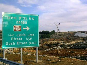
The planned route of barrier(s) in this area will incorporate 10 settlements and numerous unauthorized "outposts" on the western side of the barrier, effectively annexing more than 50,000 Israeli settlers into Israel. The settlements which are planed to be annexed this way are: Beitar illit, Har Gilo, Efrat, Elazar, Neve Daniel, Migdal Oz, Kfar Etzion, Rosh zurim, Bat Ayin, and Alon Shvut.
By routing the barrier in this manner, the entire enclave is attached not only to Israel along the Green Line (to the west) but is incorporated into the contiguous areas of Greater Jerusalem (in much the same way that the Givat Zeev settlement bloc is being annexed in a manner that expands the contiguous Greater Jerusalem area to the north). The barrier, plus a set of bypass roads which have been already constructed over the past 15 years in this area, will allow the Israeli settler population to commute to Jerusalem in a matter of a few minutes.
In addition, intense pressure led to the inclusion of Efrat - a relatively prosperous, middle class settlement - inside the barrier (as well as the neighboring settlement of Migdal Oz), even at the cost of destroying contiguity within the southern West Bank and creating a massive new point of friction between Israel and the Palestinians (discussed below).
What will be the impact on Palestinians in the area?
By now it is well known that construction of the security barrier is causing serious hardship to many Palestinians in the West Bank. In many cases they are losing their land to the barrier itself (which cuts a wide swathe, needed not only for the wall/fence, but for offset area, patrol roads, etc.) or losing access to land and crops/trees left on the western ("Israeli") side of the barrier. (The Israeli human rights group Btselem has reported extensively on the barrier and its devastating affect it is having on the Palestinian population in the West Bank).
In the case of the Gush Etzion enclave, the barrier will cause serious harm to Palestinians on both its west (Israeli) and east (Palestinian) sides.
West of the Barrier: Around 20,000 Palestinians will be trapped on the Israeli side of the barrier, cut off from the West Bank and, due to the western fence, also cut off from Israel (which they will have no right to enter). These Palestinians live in the villages of Husan, Walaja, Battir, Wadi Fukin, Jaba', Nahhalin, plus another three smaller communities, all of which are traditionally linked to Bethlehem and Jerusalem socially (including for health services and education), economically (for employment and to market agricultural goods), politically, and culturally. As is the case elsewhere in the West Bank where Palestinian villages are trapped in settlement enclaves (like the area around the town of Qalqilya), local Palestinian inhabitants will likely find their movements within the enclave tightly circumscribed (so they cannot be a threat to Israelis living there), and they will find their movement in and out of the enclave (into the West Bank) limited to a small number of Israeli-run crossing points. Inhabitants will likely be forced to obtain special permission from Israel to reside in their own homes (and some will likely be denied permission, for unspecified security reasons), and visitors from outside the enclave will be strictly restricted and require permits as well.
East of the Barrier: The barrier will enclose thousands of dunams of cultivated land belonging to Palestinians who will be left on the eastern (Palestinian) side. This will make the land inaccessible to Palestinians and deal a harsh blow to the economy and social structures of the area. Israel will likely commit to making special arrangements to give farmers access to their land on the Israeli side of the barrier, but in similar cases elsewhere in the West Bank Palestinians have often been denied regular access and certainly the kind of predictable access necessary for economic security.
Moreover, by dipping so deeply into the West Bank (mainly in order to include the settlements of Efrat and Migdal Oz), the enclave cuts off the sole major north-south transportation route in the area - Route 60. This, in effect, will intensify the trend of "canonization" of the West Bank, severing the southern West Bank completely from Bethlehem and Jerusalem, and leaving the Bethlehem area as an isolated island trapped between the security barrier around Jerusalem (to the city's north) and the Gush Etzion barrier to its west and south (to its east is the most barren and inhospitable parts of the Judean desert - not an outlet for either movement or growth). Israel is planning to construct a tunnel passing underneath Route 60, whose use will be controlled by Israel. However, this tunnel cannot meet the everyday needs of the Palestinian population of the area, a large portion of which relies on Route 60 to travel every single day for work, school, and services. Moreover, since use of the tunnel will be wholly controlled by Israel, it is probable that it will become a "chokepoint" with access cut off regularly due to security or other reasons, and effectively paralyzing movement inside the entire southern West Bank.
Are there alternative routes for the security barrier that make sense in this area?
Yes. The best solution would be to design a route that minimizes the harm caused to Palestinians in the area while improving Israel's security. Two different strategies could accomplish this:
The Green Line plus secondary fences: Rather than building a barrier that encloses a large area of the West Bank and attaches it to Israel, Israel could instead build individual fences around each settlement, separately, as it has done in dozens of other cases in the West Bank to deal with settlements that are located east of the barrier. These special security zones still harm the local Palestinian population, substantially increasing the "footprint" of the settlements on the ground, but they are much less harmful in terms of overall loss of land and disruption of patterns of life and movement.
The Green Line plus historic Gush Etzion: A second solution would be to build the barrier to include the majority of the settlements of the area (which are located in the southern part of the enclave, more or less in the historic "Etzion" area), but not include the Palestinian villages (which are located mainly in the northern part of the enclave). Secondary fences could then be constructed around settlements left on the eastern side of the barrier. Such a route would have the further advantage of leaving Efrat and Migdal Oz on the eastern side of the barrier, allowing the sole north-south route available to the Palestinians to remain intact, and avoiding the de facto cantonization of the southern West Bank. In doing so, the harm caused to the local Palestinian population would be significantly decreased, although substantial harm would still result.
This is clearly the most logical compromise, presenting a route that is shorter, includes fewer Palestinians, encompasses the historically-important settlement bloc, and does not create a massive new point of friction and pressure between Israelis and Palestinians in the heart of the West Bank. However, it is highly unlikely that such a route will be adopted, in large part because of pressure to make the expanded Gush Etzion area part of Greater Jerusalem.
Given the special Israeli attachment to Gush Etzion, are the courts and political echelons handling this case differently than other cases?
Based on the previous court cases raised against the route of the security barrier, it is possible, but unlikely, that the current cases will be decided in favor of the Palestinians. The fact that the subject of the current complaints is related to Gush Etzion, an area which has historic resonance for Israelis (even if the areas in question have little to do with the actual historic site), will not make it easier for the court to take the brave step of ruling against the government.
It is worth noting that some of the Palestinian complainants in Gush Etzion have found allies both in Israel - in the form of pro-environment and ecological groups (the Wadi Fukin area is home to unique natural springs) - and among some of the residents of neighboring settlements, some of whom object to the construction of any barrier for ideological reasons, and some of whom care about the harm the barrier will cause to their traditionally peaceful Palestinian neighbors.
What is happening right now in the area in terms of construction in settlements?
The area west of the planned route of the security barrier in the Gush Etzion region is also the location of some of the most significant construction taking place today in the West Bank, focused in the ultra-orthodox settlement of Beitar Illit. In addition, there is a significant amount of construction also taking place in the settlements of Efrat, Neve Daniel, Ela'zar and Rosh Tzurim.
What will be the impact of the barrier on Gush Etzion settlements left on the "wrong" side?
By now most observers - including the settlers - have come to the conclusion that, notwithstanding continued Israeli Government statements to the contrary, the route of the barrier represents an effort to unilaterally determine the future borders of the state of Israel. As a result, there are intense efforts by settlers to see their settlements included inside the barrier (as has been the case with Efrat). There is also clear recognition among the settlers that settlements left on the east side of the security barrier are likely to be conceded by Israel in the context of any future negotiations and political agreement with the Palestinians.
However, this does not mean that the settlers left on the "wrong" side of the barrier are giving up, or that the Government of Israel is not still investing in them. To the contrary, Israel is continuing to develop areas which are planned to remain east of the barrier, and continuing to invest huge sums of money in the effort. The most egregious example of this is what has become known as the "Lieberman Road" - a bypass road which, over the past four years, has been carved into the hills between Jerusalem and the small, relatively isolated settlements of Tekoa and Nokdim, together home to less than 200 people. The road is named for Avigdor Lieberman, now the Minister of Strategic Threats in the Olmert Government, who lives in Nokdim. Its construction was approved, not coincidentally, during Leiberman's term as Minister of Transportation under the Sharon government. At a total length of about 10 kilometers and costing tens of millions of shekels to build and pave, the Leiberman Road will ultimately serve -exclusively - these two small settlements, both of which are likely to be removed in the context of any future peace agreement.
Assuming the route of the barrier is not changed, how will it impact the chances for a future peace agreement between Israel and the Palestinians?
In an article published October 1, 2006, in the Washington Post, veteran Israeli journalist Gershom Gorenberg lays out the case in stark terms:
"...To pursue this project today makes no sense. Olmert's vision of unilateral withdrawal was intended to end rule over the Palestinians and guarantee Israel's Jewish majority, yet allow Israel to keep major settlements. But the conditions created inside enclaves such as the Etzion area are an affront to Israel's democracy and a guarantee of continuing conflict with the Palestinians.
"What's more, the summer's battles in Gaza and Lebanon have shattered support in Israel for unilateralism. Without peace, a fence is not enough to protect the country. It is now clear that Israel can pull back safely only if it does so as part of a negotiated agreement. And there is no chance of an accord that will leave large settlement blocs in Israel's hands.
"The Israeli Supreme Court is expected to rule soon on lawsuits by Palestinians against the Etzion area fence. Yet the slim chance of judicial salvation does nothing to explain why Olmert's government continues to invest in the failed project of the settlements, which for nearly 40 years has drained Israel's energies, subverted its democracy and harmed its security.
"Nor is there any reasonable explanation for why Israel's strategic ally, the United States, virtually ignores what is happening in the Etzion area. The Bush administration has recently shown some inconsistent interest in restarting the Israeli-Palestinian peace process. Yet, following a long, mistaken tradition in American diplomacy, it pays more attention to negotiating stances than to the shifting reality in the region.
"Meanwhile, out on Highway 60, the bulldozers are preparing a monument to a doomed policy."
Produced by Lara Friedman, Americans for Peace Now,
and Dror Etkes, Peace Now